Sunday, March 10, 2013

Historical Settlement of North America

Historical Settlement of Alaska 


In July 1867, shortly after Congress ratified the treaty to purchase Alaska, more than 30 ships sailed from San Francisco to Alaska. Most went to the Russian center at Sitka, a few to trading posts at Wrangell, Kodiak, Kenai and Unalaska, St. Michael and the Pribilof Islands. Those heading north wanted to engage in trade and commerce, to exploit Alaska's natural resources, or they went because the government sent them.
The U.S. Government did what it usually did after acquiring new territory. It classified Alaska as "Indian country" and sent the U.S. Army to the territory. The Army built posts at Sitka, Kodiak, Kenai, Wrangell, Tongass Island, and the Pribilof Islands. The posts were expensive to operate and staff. The Army closed all but the Sitka post by 1870. Other departments of government sent officials to Alaska. The Treasury Department sent customs collectors and revenue marine service vessels to collect taxes and enforce laws against smuggling. The U.S. Navy sent ships to support the Army.
For the first dozen years of U.S. administration of Alaska, Americans had a small number of government personnel living in a few widely isolated outposts, supported by Navy and Treasury Department ships, a small year-round civilian non-Native population, and a seasonal increase in laborers.. In 1880, the U.S. Census Office appointed Ivan Petroff to take the first American census of Alaska. It was impossible for him to visit every part of Alaska, but he visited Cook Inlet, Kodiak Island, the Alaska Peninsula, some Aleutian Islands, part of the Bering Sea coast, and the lower portions of the Yukon and Kuskowkim rivers. He counted 33,426 people, 430 non-Native, 1,756 Creole, and almost 33,000 Native. His report provided a great deal of information about Alaska's geography and resources.
The discovery of gold in Canada's Klondike attracted thousands of people to Alaska. Between 1890 and 1900, the population of Alaska nearly doubled, to about 63,000 people. Most of the people who came north planned to strike it rich and leave.. Some people did stay however. In 1910, the census report count was 64,356 people in Alaska. Forty years later the population almost doubled to 128,643 people.
During the early 1900s, most Alaskans lived near the ocean or along major rivers where ships and boats could provide supplies and transportation. Later, communities grew up next to railroads and roads, and still later, to airfields. Some of the American settlements came to be because of resources, such as minerals, that could be economically developed. People in these communities petitioned the government for trails and roads, and tried to get railroads built to connect them with others and to lower freight and transportation costs.
Before the Klondike gold rush of 1898, Americans started a number of new settlements around Alaska. Juneau began as a mining camp in 1880, and Douglas, across the channel, was founded a year later. Hope on the Kenai Peninsula, Circle City on the middle Yukon River, and Council on the Seward Peninsula started as mining camps before 1898. Several towns like Ketchikan began as fishing villages or as cannery sites like Karluk on Kodiak Island and Homer on the Kenai Peninsula. Others started as mission stations, such as Haines and Bethel. In Northwest Alaska, whalers and traders established shore-based whaling stations at Barrow and Wainwright.

Fairbanks Alaska, 1904
Photograph of a 4th of July crowd in Fairbanks, Alaska.
The Klondike gold rush caused supply camps to be built along the routes people traveled to the gold fields. Skagway and Valdez began as supply camps. Gold camps, such as Nome and Fairbanks survived while others such as Iditarod and Chisana did not.
In the mining areas, large corporations moved in after the initial stampede. The big companies purchased claims, brought in drag lines, hydraulic equipment and dredges, and hired large crews to work. These companies, at places such as the Treadwell gold mines at Douglas and the Kennecott copper mines in the Wrangell Mountains, established company towns. The company owned the land and constructed boarding houses, dormitories, mining offices, and other community buildings. Workers paid room and board. The company offered bowling alleys, gymnasiums, movies, and reading rooms.

Cordova, Alaska, 1910
View of First Street, Cordova, Alaska.
Although seasonal, many canneries were also "company towns". The owners transported workers to a cannery in the spring and returned them to their home base in the fall. At the canneries, the owners provided food, lodging, and some recreational facilities. Many canneries used contract crews. Usually the crews were Chinese, Filipinos, and Mexicans. They had separate facilities at a cannery and did not mix with the other cannery workers or fishermen. At each company town in Alaska, when the owners stopped mining or canning operations, the town was abandoned.
The gold discoveries and people rushing north led the U.S. Army to return to Alaska and establish six posts to maintain order. These posts were complete communities. Around the posts, communities grew, providing goods and services.When the posts were closed down, the local communities declined. This same pattern occurred during and after World War II and the Cold War.
Starting construction in 1900, the U.S. Army built Alaska's first significant road and a telegraph system. The Trans-Alaska Military Road went from Valdez north and east to Fort Egbert, the army's headquarters near Eagle on the Yukon. The Army constructed a 1,900 mile long telegraph to connect the six army posts. Along the telegraph routes, small communities grew around telegraph stations and roadhouses were built to serve workers and travelers, including the U.S. mail carriers.
Several private companies built railroads after the gold discoveries. Seward was founded as the southern end for a road that would cross the Kenai Peninsula and then head north to Fairbanks. Cordova was the seaport end for the railroad to bring the rich Kennecott copper out of the Wrangell Mountains. Stations along these routes grew into small towns.
When the U.S. Government built the Alaska Railroad between 1915 and 1923, it encouraged communities along its route. Anchorage began as the southern railroad construction camp. Nenana was the main construction camp for the northern section of the railroad. It was also the home port for the steamboats that the railroad operated to serve communities on the Tanana and Yukon rivers. The railroad surveyed townsites and sold lots at Anchorage and Nenana, Wasilla and Talkeetna.
The gold rush era ended about 1912. The population of the territory declined and when the U.S. entered World War I, more people left Alaska. The population in 1920 was recorded as 55,036. That census was the first to report more non-Natives than Natives in the territory. Alaska's population did not significantly increase again until World War II. Then large naval stations opened at Sitka, Kodiak, and Unalaska and large army posts opened at Fairbanks and Anchorage. Air fields were constructed on Annette Island, at Yakutat, Galena, Gulkana and Bettles. The Glenn and Alaska highways were built.
A number of soldiers and construction workers decided to live in Alaska after the war. There were many job opportunities. The military started to build communication sites around Alaska to provide early warning of planes from the Soviet Union heading for the 48 states. It was part of the defense for the Cold War.
Most of the people who moved to Alaska after World War II settled in larger communities. Many rural Alaskans moved to the cities as well, for jobs and better access to goods and services. The Anchorage area grew the most.
In the late 1950s, oil was discovered on the northern Kenai Peninsula and in Cook Inlet. Then the largest oil field in North America, at Prudhoe Bay, was discovered in 1967. During the 1970s, the population of Alaska nearly doubled. People came to work in the oil fields, to build the Trans-Alaska Pipeline, and to provide services to the workers. The communities of Anchorage, Fairbanks, and Valdez could not house all the people arriving. Eagle River and the Matanuska Valley grew as Anchorage suburban areas, as did North Pole and Ester, outside of Fairbanks.
Alaska's population was counted as 626,932 in 2000. Of this total, 98,043 are Natives. They are 17% of the population. That year, Alaska was no longer the state with smallest population. It does have the fewest people per square mile. Over half of the state's population lives in the Southcentral area. The state's population is more ethnically diverse than it was 25 years ago. The number of African Americans has increased, as has that of Asians, Pacific Islanders, and Hispanics. (http://www.akhistorycourse.org/articles/article.php?artID=231)

The Atlantic Periphery

Like the Atlantic Periphery, glaciers are a prominent part of the Alaska. There is an estimated 100,000 glaciers that cover the area. According to the textbook, a glacier is a large shed of ice covering major portions of the earth's surface. Glaciers are glorious landforms that are beautiful to look at and also dangerous to water navigation. As glaciers do not always show above the water surface, it is difficult to detect where one actually is in the water. Although technology today has made it much easier to detect glaciers, it is still important to use caution. In the cases of glaciers, boat captains have to be extremely careful in order to avoid tragic situations such as the Titanic.

If carefully avoided, glaciers can be extremely beautiful to look at. The landforms range in sizes and attract many tourists from all over the world. It is common for tourists who visit Alaska to take boat trips and other excursions to get good views of icebergs and glaciers.

Alaskan Glaciers
 
McBride Glacier in Glacier Bay
NPS
McBride Glacier in the Glacier Bay National Park
Glacier BayMcBride Glacier, the only tidewater glacier in the East Arm, is approximately 40 nautical miles from Bartlett Cove.
If you are kayaking, McBride Glacier is a good destination because it attracts fewer motorized vessels and is a very active glacier. However never paddle (or take a boat) into McBride Inlet due to its hazardous entrance.
Tidewater glaciers consist of recurring periods of advance alternating with rapid retreat and punctuated by periods of stability. During portions of its cycle, a tidewater glacier is relatively insensitive to climate change.


Matanuska Glacier in the Fall
AK DOT
Matanuska Glacier
Southcentral Alaska Glaciers
The Matanuska (Mat-Su) Glacier  
One of the most beautiful glaciers in Alaska accessible by car. It is about two hours north of Anchorage on the Glenn Highway National Scenic Byway.
A state recreation site offers 12 campsites and trails to glacier viewing.

 
Portage Glacier
USFS
Portage Glacier
Portage Glacier
One of the most visited glaciers in the Chugach National Forest, an hour (50 miles) south of Anchorage off the Seward Highway.

The Begich, Boggs Visitor Center is your gateway to the glaciers. The Center offers opportunities to learn about the Chugach National Forest and glaciers with fun and interactive exhibits.

From the center one can take a short boat trip to view the glaciers or hike along the nature paths.


Spencer Glacier boat trip
NPS CHRIS SMITH
Boat tour at Spencer Glacier
Spencer Glacier
Also located in Chugach National Forest, can only be accessed by railroad from Anchorage or Portage.
A short hike (3/4 mile) allows visitors a view of the glacier and a raft trip down the river to the train if desired.


Exit Glacier
NPS
Exit Glacier
Exit Glacier
Is one of the most visited glaciers in the state, and the only part of the Kenai Fjords National Park accessible by road.
Visitors can take a short walk to reach the face of the glacier or hike a little further to the Harding Icefield.
There are 12 campsites available from Memorial Day through Labor Day.


Columbia Glacier, Valdez, Alaska
CARL TAPE
Columbia Glacier
Prince William Sound Glaciers
The Columbia Glacier
Named after the elite ivy-league school in 1899 by the Harriman Alaska Expedition.
It is approximately 400 square miles, 32 miles long and 1,800 feet thick.
The glacier can be viewed by boat tours or ferry from both Valdez and Whittier.

 
Worthington Glacier
USGS
Worthington Glacier
Worthington Glacier
Located just north of Valdez by road.
The average amount of snowfall in the mountains that feed this glacier is over 250 inches per year.
There is a state recreation site which allows visitors to view the glacier and its moraines.

 
Mendenhall Glacier Juneau, AK
USGS
Mendenhall Glacier
Southeast Alaska Glaciers
Mendenhall Glacier
Formerly known as Sitantagu (meaning "The Glacier Behind the Town").
Located near Juneau in the Tongass National Forest.
The visitor center near the glacier is the first visitor center built in the nation (dedicated in 1963).
There are elevated access boardwalks for wildlife viewing and trails for more glacier observing opportunities.

 
Malaspina Glacier
NPS
Malaspina Glacier
The Malaspina Glacier
Located in Wrangell-St. Elias National Park and Preserve.
This glacier is the largest piedmont glacier in North America; spanning 60 miles across.
It covers 850 square miles, which is almost the same size as Rhode Island.
(http://www.alaskacenters.gov/glaciers-in-alaska.cfm)

The North American Political Economy

Chapter 4 discusses the importance of agriculture in the primary sector. As agriculture can not keep up in Alaska, people have found luck in the fishing and livestock industry, specifically with reindeer.

Fishing


Alaska’s commercial fisheries are diverse, valuable, harvest a variety of finfish and shellfish species, and include both large and small vessels. Catcher processors over 300 feet in length operate in the Bering Sea pollock fishery while open skiffs of 20 feet fish for salmon, herring, and halibut close to shore. In between all sizes and configurations of vessels work their respective fishing grounds.
Alaska’s largest and most valuable fisheries target salmon, pollock, crab, herring, halibut, shrimp, sablefish, and Pacific cod. The total value of Alaska’s commercial fisheries is $1.5 billion to the fishermen; with a wholesale value of $3.6 billion. Economists have estimated the seafood industry to contribute $5.8 billion and 78,500 jobs to the Alaskan economy. Fisheries management in Alaska is based on scientific assessments and monitoring of harvested populations and is regarded as a model of successful natural resource stewardship. (http://www.adfg.alaska.gov/index.cfm?adfg=fishingCommercial.main)

Livestock

Congress appropriated funds from 1896 until 1902 to purchase more reindeer from Russia. Small reindeer herds were distributed to mission schools on the Seward Peninsula and throughout western Alaska under the direction of Jackson, to teach Native Alaskans to herd. Additional herds were established along the route to Point Barrow in 1898 when Jackson ordered a drive of over 400 reindeer to an ice-bound ship of starving sailors.
With the discovery of gold in Nome in 1898, reindeer were used to their full potential. There was a large demand for meat and reindeer were used to pull sleds of gear for the miners. The first postal reindeer route was established between St. Michael and Kotzebue in 1899. Reindeer were preferred to dogs for carrying supplies, as they were less expensive and they could graze freely, whereas food needed to be carried for the dogs.
Jackson continued to use reindeer as a means for teaching Native Alaskans English so they could do business with white people. Girls were taught sewing and housework, while men and boys continued to apprentice as reindeer herders. A reindeer apprentice required five years of schooling with room and board. They earned two female reindeer and their calves per year. After five years, the new herder is loaned enough reindeer to increase his herd size to 50 head.
In 1906, a government investigation by the Department of the Interior found that Scandinavians and mission schools rather than Native Alaskans owned a majority of the reindeer in Alaska. As a result, a new government policy was established with the goal of placing more reindeer into Native ownership and Dr. Jackson's serviced were ended. By 1913, Alaskan Natives owned over 30,000 or 65% of the reindeer in Alaska. By the late 1920s there were over 400,000 reindeer in western Alaska and the population peaked at 640,000 reindeer in the 1930s! In 1937, the Reindeer Act was passed which restricted ownership to Native Alaskans. This act is still in place today.
By the 1950s approximately 50,000 reindeer were present on the Seward Peninsula. Reasons for the sharp decline are the harsh winter of 1938-39, losses to migrating caribou, predation by wolves, and the lack of attendance to herds. In the 1960s there was a gradual selection of Native Alaskan owners to become private reindeer herders with designated ranges. In 1968, the Bureau of Indian Affairs (BIA) became responsible for range management by issuing grazing permits and monitoring range condition. Soon after, modern range management techniques were applied to reindeer herding. Reindeer herding in Alaska has been a cultural and traditional mainstay in many western villages. The traditions surrounding reindeer herding and the use of their products continues today.
Currently, there are approximately 20 reindeer herders and 20,000 reindeer in western Alaska. These herders belong to the Reindeer Herders Association, which is part of the Kawerak, Inc. Natural Resources Division. This group provides assistance in the development of a viable reindeer industry to enhance the economic base for rural Alaska and to improve the management of the herds. An additional 10,000 reindeer exist in herds on Nunivak, St. Paul, Umnak, and other Aleutian Islands along with a few fenced herds along Alaska's road system. In the lower 48 states, there are approximately 1,000 reindeer, which are owned by private farms and zoos.

Megalopolis

Megalopolis discusses the densely populated urban corridor of the United States, specifically the cities on the Northeast Coast. While Anchorage is not as urbanized as the Megalopolis and is located on the complete opposite side of the continent, the city has a large urban sector.


Quick Stats
Population in 2011: 293,356. Population change since 2000: +12.7%


Males: 148,986  (50.8%)
Females: 144,370  (49.2%)

Median resident age:  32.9 years
Alaska median age:  36.1 years

http://www.city-data.com/city/Anchorage-Alaska.html#ixzz2NCUEf42L


Russian presence in south central Alaska was well established in the 19th century. In 1867, U. S. Secretary of State William H. Seward brokered a deal to purchase Alaskafrom an Imperial Russia for $7.2 million (about two cents an acre). The deal was lampooned by political rivals as "Seward's folly", "Seward's icebox" and "Walrussia". By 1888, gold was discovered along Turnagain Arm.
In 1912, Alaska became a United States territory. Anchorage, unlike every other large town in Alaska south of the Brooks Range, was neither a fishing nor mining camp. The area within tens of miles of Anchorage is barren of significant economic metal minerals. While a number of Dena'ina settlements existed along Knik Arm for years, only twowhite men, Bud Whitney and Jack Brown, were reported to have lived in the Ship Creekvalley in the 1910s prior to the large influx of settlers.
The city grew from its happenstance choice as the site, in 1914, of a railroadconstruction port for the Alaska Engineering Commission. Construction of the railroad, to be known as the Alaska Railroad, continued until its completion in 1923. The area near the mouth of Ship Creek, where the railroad headquarters was located, quickly became a tent city. A town site was mapped out on higher ground to the south of the tent city, greatly noted in the years since for its order and rigidity compared with other Alaska town sites. Anchorage was incorporated on November 23, 1920.[5]
The city's economy in the 1920s and 1930s centered on the railroad. Col. Otto F. Ohlson, the Swedish-born general manager of the railroad for nearly two decades, became a symbol of residents' contempt for the firm control he maintained over the railroad's affairs, which by extension became control over economic and other aspects of life in Alaska.
Between the 1930s and the 1950s, the city experienced massive growth as air transportation and the military became increasingly important. Aviation operations in Anchorage commenced along the firebreak south of town (today's Delaney Park Strip), which was also used by residents as a golf course. An increase in air traffic led to clearing of a site directly east of town site boundaries starting in 1929, which became Merrill Field. Merrill Field served as Anchorage's primary airport during the 1930s and 1940s, when it was replaced by Anchorage International Airport upon its opening in 1951. Merrill Field still serves a significant amount of general aviation traffic to this day.
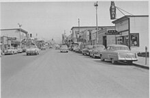
Fourth Avenue in 1953, looking east from near I Street. Just five years before, the area in the foreground was mostly home to lumber yards and other light industrial uses.
Elmendorf Air Force Base and Fort Richardson were constructed in the 1940s, and served as the city's primary economic engine until the 1968 Prudhoe Bay discoveryshifted the thrust of the economy toward the oil industry. The 2005 Base Realignment and Closure process led to the combining of the two bases (along with Kulis Air National Guard Base) to form Joint Base Elmendorf-Richardson.
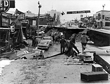
The Good Friday or "Great Alaska" Earthquake on March 27, 1964. View of Fourth Avenue.
On March 27, 1964, Anchorage was hit by the magnitude 9.2 Good Friday Earthquake, which killed 115 people and caused $311 million ($2.33 billion current value)[6] in damage.[7][8] The earth-shaking event lasted nearly five minutes; most structures that failed remained intact the first few minutes, then failed with repeated flexing.[7][8] It was the second largest earthquake in the recorded history of the world.[7][8] Rebuilding dominated the remainder of the 1960s.
In 1968, oil was discovered in Prudhoe Bay, and the resulting oil boom spurred further growth in Anchorage. In 1975, the City of Anchorage and the Greater Anchorage Area Borough (which includes Eagle RiverGirdwood, Glen Alps, and several other communities) merged into the geographically larger Municipality of Anchorage.[5] The city continued to grow in the 1980s, and capital projects and an aggressive beautification campaign took place. (http://en.wikipedia.org/wiki/Anchorage,_Alaska)

The Great Lakes and Corn Belt

This section will be used to discuss the many lakes and farming that goes on in Alaska.
As you can see from the photograph above, Alaska is home to numerous lakes. Contrary to popular belief, Minnesota does not host the most lakes in the United States, Alaska does. The major lakes in Alaka are Iliamna Lake, Clark Lake, Minchumina Lake, Aleknagik Lake and Becharof Lake. 

Iliamna Lake

Clark Lake
Minchumina Lake
Aleknagik Lake
Becharof Lake

Agriculture

Farming

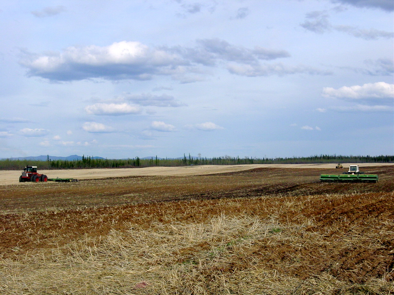
Agriculture so far in Alaska has not been able to keep up with the demand for farm products. In 1940 Alaskans were importing from the States $8,200,000 worth of farm products a year, including $1,000,000 worth of vegetables, and $5,000,000 worth of meat. Since 1940, due to the war, imports have increased enormously. But there is no doubt that a large market will continue to exist for Alaskan farmers’ products, providing they can raise them and get them to market.
There are four principal farming areas in Alaska: the Tanana Valley, the area near Homer on Kenai Peninsula, parts of Kodiak Island, and the Matanuska Valley.
Matanuska, the most famous of these, is populated by about 2,250 persons, including the residents of the towns of Palmer and Wasilla. There are about 250 farms in the valley, 144 of which were established by the Alaska Rural Rehabilitation Corporation, which started the Matanuska Valley Colonization Project in 1935. Farmers have cleared about 6,000 acres of land and own about 700 dairy cows, some 600 hogs, 1,200 sheep, about 100 horses, and approximately 100 beef cattle.
The chief types of farming in the valley are dairying, general farming, truck farming, and poultry raising. Most of the farmers sell their products through their cooperative, which operates a creamery in Palmer and a dairy in Anchorage. Dairy farming has proved profitable for farmers, but they have found it best to raise from their farms all the vegetables and food crops they can for family living.
Matanuska lies on about the same latitude as Leningrad, USSR, or Oslo, Norway. In the last 19 years, temperatures in the valley have averaged 13° above zero in January and 58° in July. Precipitation over the same period averaged 15.5 inches a year. There is an average growing season of 108 days. The soil is a rich loam. There are few pests or noxious weeds and no snakes—but plenty of mosquitoes!
Farms of 80 to 160 acres owned by the Alaska Rural Rehabilitation Corporation sell, when vacant, from about $4,500 to $6,000, with about one-fifth down payment. These farms may be leased the first year. Other farms are sometimes available from private owners. Undeveloped government land may be purchased at prices ranging from $1.25 to $5.00 per acre. It is usually covered with birch-spruce forest, and must be cleared before it can be farmed. Special settler’s steamship rates can be secured by farmers bringing their own equipment and machinery. If possible, the settler should bring with him livestock, farm machinery, tools, and furniture. (http://www.historians.org/projects/giroundtable/Alaska/Alaska9.htm)

The Inland South

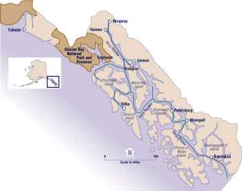
The Inside Passage is what is considered the "Inland South" in Alaska. It is on the southeast side of Alaska but is significant in that it provides for easier transportation of goods and attracts many tourists. The Inside Passage is a coastal route for oceangoing vessels along a network of passages which weave through the islands on the Pacific coast of North America.


The Coastal South

The south coast region is the most maritime part of the mainland, as opposed to the island chain that makes up southwestern Alaska or the archipelago of the southeast. Of the five stations with long records in this part of Alaska, Kodiak is located on an exposed island, Seward and Valdez are on tidewater in somewhat protected fjords, and Cordova and Yakutat are on glacial outwash plains directly exposed to the Gulf of Alaska. (http://climate.gi.alaska.edu/history/South.html)


North America's Environmental Setting


Geography of Alaska


Land area: 
With 586,412 square miles, or about 365,000,000 acres, Alaska is the largest state in the union and; one-fifth the size of the lower 48 states. 
Area per person: Approximately .91 square mile per person.
Diameter: East to west, 2,400 miles; north to south, 1,420 miles.
Coastline: 6,640 miles, point to point; as measured on the most detailed maps available, including islands, Alaska has 33,904 miles of shoreline. Estimated tidal shoreline, including islands, inlets and shoreline to head of tidewater, is 47,300 miles. 
Adjacent salt water: North Pacific Ocean, Bering Sea, Chukchi Sea, Arctic Ocean. 
Alaska-Canada border: 1,538 miles long; length of boundary between the Arctic Ocean and Mount St. Elias, 647 miles; Southeast border with British Columbia and Yukon Territory, 710 miles; water boundary, 181 miles.
Geographic center: 63° 50' north latitude, 152° west longitude, about 60 miles northwest of Mount McKinley.
Northernmost point: Point Barrow, 71° 23' 25" north latitude, 156° 28' 30", west longitude.
Southernmost point: Tip of Amatignak Island, Aleutian Chain, 51° 15' 44" north latitude, 179° 06' 31" west longitude. 
Easternmost and westernmost points: The easternmost and westernmost points depend on whether you look at it from the global geographic perspective considering the longitudinal meridians, or just west=left, east=right.
The 180th meridian, (halfway around the world from the Prime Meridian at Greenwich, England) is the global dividing line between all eastern and western longitudes and happens to pass through Alaska's Aleutian Island chain. That means, when taking the global geographic perspective, Alaska has both the easternmost and westernmost spots in the entire country! The piece of land with the most westerly longitude is Amatignak Island at 179° 06' 31" west, just shy of the 180th meridian. Only 70 miles away, in a westerly direction but on the other side of the meridian, is Pochnoi Point on Semisopochnoi Island, with the most easterly longitude of 179° 46' east.
The chain continues in a westerly direction for approximately another 300 miles to Cape Wrangell on Attu Island, which is the farthest piece of land that one can travel to in a westerly direction in the state. If one is facing north and not considering the global longitudinal lines, this would be considered the farthest western point in the state. Looking to the right, to the east, and using the same criteria of not considering the global longitudinal lines, the farthest eastern point in the state is near Camp Point in southeastern Alaska.
Tallest mountain: Mount McKinley, at 20,320 feet, is the tallest mountain in North America. Alaska has 39 mountain ranges containing 17 of the 20 highest peaks in the United States.
Largest natural freshwater lake: Iliamna, with 1,150 square miles. Alaska has 94 lakes with
surface areas of more than 10 square miles among Alaska's more than 3 million lakes.
Longest river: Yukon, with 1,875 miles in Alaska and 2,298 total. There are more than 3,000 rivers in the state. The Yukon River ranks third in length of U.S. rivers, behind the Mississippi and Missouri rivers.
Largest island: Kodiak, in the Gulf of Alaska, with 3,588 square miles. There are 1,800 named islands in the state, 1,000 of which are located in Southeast Alaska.
Largest glacier: Bering Glacier complex, with 2,250 square miles, includes the Bagley Icefield. Ice fields cover about 5 percent of the state, or 29,000 square miles.
Largest city in population: Anchorage, population 250,006 (1994 estimate).
Largest city in area: Sitka, with 4,710 square miles, 1,816 square miles of which are water. Juneau is second, with 3,108 square miles, part of which is ice field. (http://www.alaska.gov/kids/learn/aboutgeography.htm)


Alaskas physical setting is beautiful and much better captured by video. Below is a YouTube link to view the land:


http://www.youtube.com/watch?v=HnzEZQ0p_Ao

Introduction


South: 51° 13’ N. at the tip of Amatignak Island in the Aleutian Islands
North: 71° 23’ N. at Point Barrow
East (towards Canada): 129° 59’ W. at Cape Point in Southeast Alaska
West (towards Russia): 172° 27’ E. at Cape Wrangell on Attu Island


Alaska flag
Governor: Sean Parnell, R (to Dec. 2014)
Lieut. Governor: Mead Treadwell, R (to Dec. 2014)
Senators: Mark Begich, D (to Jan. 2015); Lisa Murkowski, R (to Jan. 2017)
Atty. General: John J. Burns (apptd. by gov.)
Organized as territory: 1912
Entered Union (rank): Jan. 3, 1959 (49)
Constitution ratified: April 24, 1956
Motto: North to the Future
flowerforget-me-not (1949)
treesitka spruce (1962)
birdwillow ptarmigan (1955)
fishking salmon (1962)
song“Alaska's Flag” (1955)
gemjade (1968)
marine mammalbowhead whale (1983)
fossilwoolly mammoth (1986)
mineralgold (1968)
sportdog mushing (1972)
Nickname: The state is commonly called “The Last Frontier” or “Land of the Midnight Sun”
Origin of name: Corruption of Aleut word meaning “great land” or “that which the sea breaks against”
10 largest cities (2010): Anchorage, 291,826; Fairbanks, 31,535; Juneau, 31,275 Sitka, 8,881; Wasilla, 7,831; Kenai, 7,100; Ketchikan, 8,050; Palmer, 5,937; Kodiak, 6,130; Bethel, 6,080;
Land area: 570,665 sq mi. (1,4 81,353 sq km)
Geographic center: 60 mi. NW of Mt. McKinley
Number of boroughs (counties): 27
Largest borough by population and area: Anchorage, 291,826 (2010); Yukon-Koyukuk, 145,900 sq mi.
State parks: more than 100 (3.5 million acres)
Residents: Alaskan
(http://www.infoplease.com/ipa/A0108178.html)