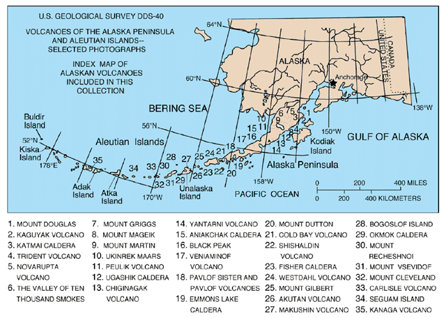


The Aleutian Islands (English pronunciation: /əˈl(j)uːʃən/; possibly from Chukchi aliat, "island") are a chain of 14 large volcanic islands and 57 smaller ones,[1] forming part of the Aleutian Arc in the Northern Pacific Ocean, occupying an area of 6,821 sq mi (17,666 km²) and extending about 1,200 mi (1,900 km) westward from the Alaska Peninsula toward the Kamchatka Peninsula, marking a line between the Bering Sea and the Pacific Ocean. Crossing longitude 180°, they are the westernmost part of the United States (and by one definition the easternmost; see Extreme points of the United States). Nearly all the archipelago is part of Alaska and usually considered as being in the "Alaskan Bush", but at the extreme western end the small, geologically related, and remote Commander Islands are in Russia. The islands, with their 57 volcanoes, are in the northern part of the Pacific Ring of Fire. The Alaska Marine Highway (a ferry service) passes through the islands. (wikipedia)

The "Ring of Fire" (map) is an arc stretching from New Zealand, along the eastern edge of Asia, north across the Aleutian Islands of Alaska, and south along the coast of North and South America. The Ring of Fire is composed over 75% of the world's active and dormant volcanoes.

No comments:
Post a Comment